Challenge  

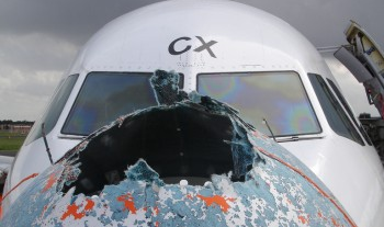
Thunderstorms constitute the most dangerous weather phenomena for aviation. Especially in data-poor regions (e.g. Atlantic, Mediterranean Sea) without weather radar coverage a forecast of the exact location, height and time of occurrences of thunderstorms as well as lightning, icing, hail, turbulence, and downdrafts continue to be a challenge for pilots. Modern civil and military aviation, however, need precise weather hazard information in order to plan in advance and enable the mitigation of weather hazard effects.

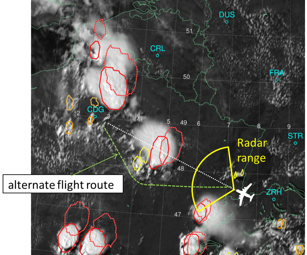
Optimized route planning esp. for unmanned aircraft (such as NATO-AGS, HAPS), for sensitive cargo and refuelling as well an improved recognized air picture can be enabled by satellite based thunderstorm detection and nowcasting up to one hour. In addition this weather hazard data can be integrated with other aviation weather data based on spatio-temporal data cubes.

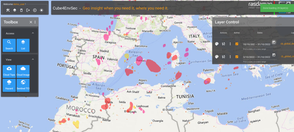
Strategic flight planning around thunderstorms (source: Cb-global by WxFUSION)

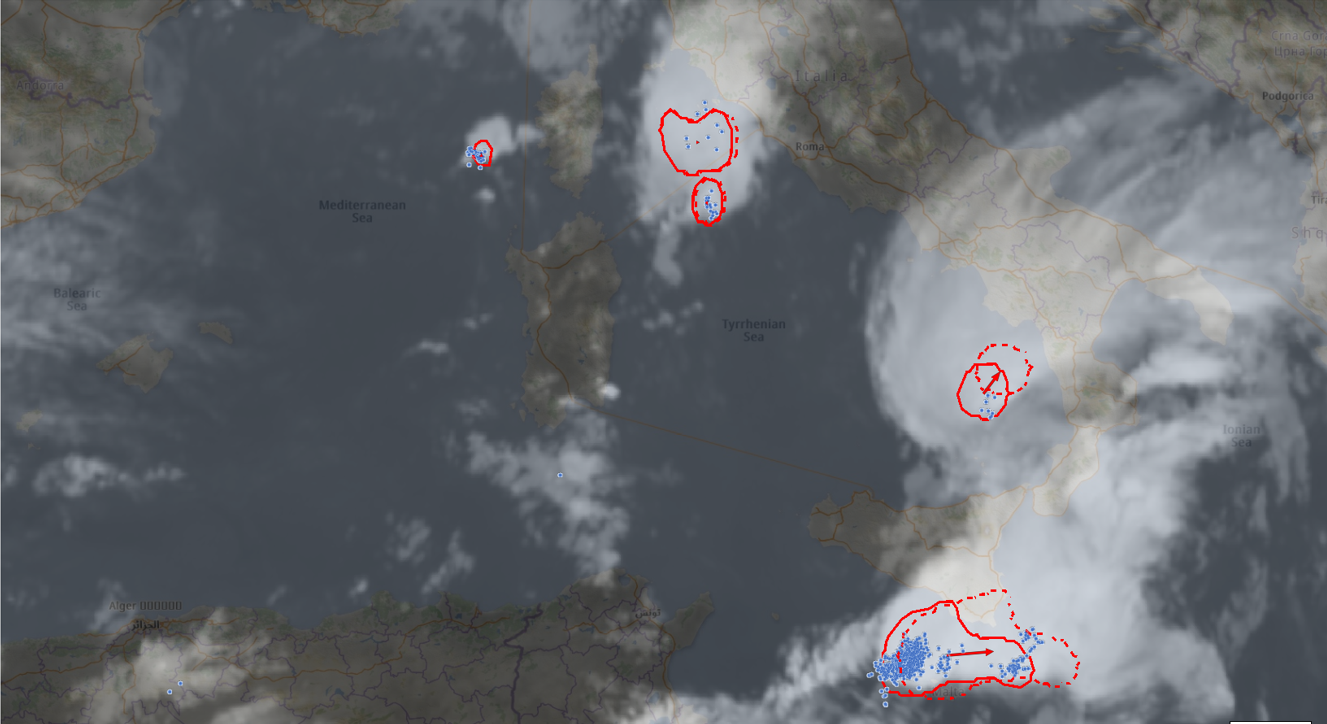
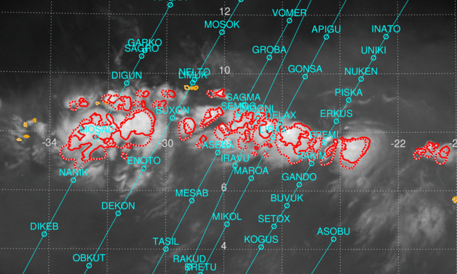
Thunderstorms around Sigonella NATO Alliance Ground Surveillance (source: Cb-global by WxFUSION)


  Capability Demonstrated  

The service holds timeseries datacubes of thunderstorm information, federated with lighting hazard and further aviation-relevant weather datacubes sitting on other servers. Data are collected since 2022 with a 5min temporal resolution.

Visualization of both base data and weather-relevant derived products is available through the rasdaman dashboard client as well as any OGC compliant 3rd party client. This allows displaying thunderstorm hazards over target regions, such as the NATO Sigonella AGS area. The effects of climate change get recorded by measuring the height of severe thunderstorms and their regional frequency.


This demonstrator is in addition and complementary to the existing WxFUSION Cb-global product which provides real-time thunderstorm and lighting hazard information over defined regions with an aviation-tailored visualization. In Cube4EnvSec, these Cb-global thunderstorm hazard data get combined with further distributed services offering aviation weather forecast data by German Weather Service (Deutscher Wetterdienst, DWD) and Swiss MetAir AlpTherm data and with lightning data from Tel Aviv University. All these rasdaman datacubes get federated in a location-transparent manner allowing for zero-coding distributed data fusion.


  Benefit  

Together with the Cb-global service this offers significant advantages:


  Demonstrator  

Contact us

By using the service you accept the Cube4EnvSec Terms & Conditions.


  Contributors  

Weather hazard data by WxFUSION GmbH, service setup and operation by rasdaman GmbH, project management by Constructor University L-SIS Research Group.


  Terms of Reference 

This service is part of the Cube4EnvSec project whose Terms of Reference apply in full.

Image credits: Sabrina de Polo NUR Photo REX; WxFUSION; EUMETSAT; ATRDRIVER.